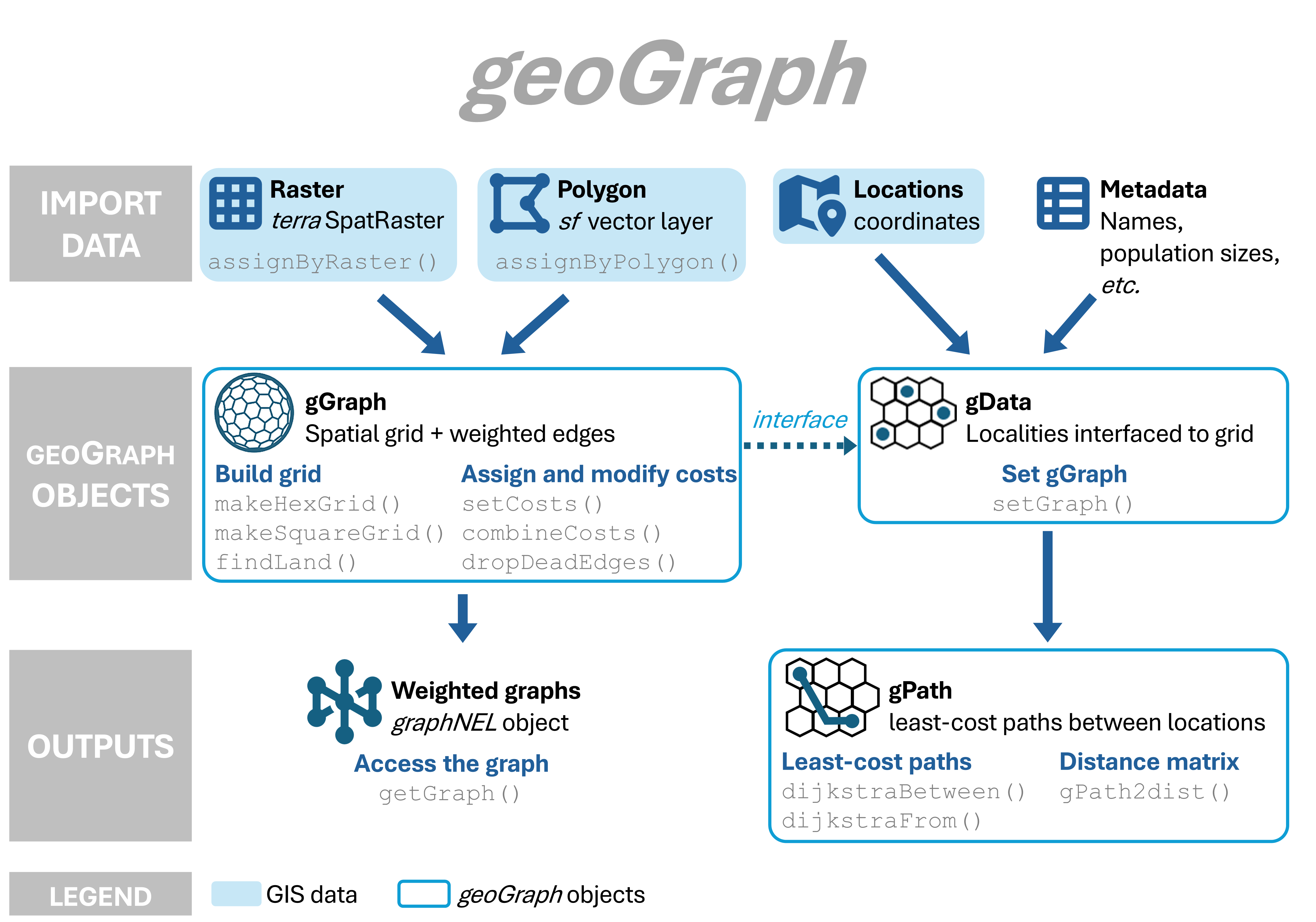
geoGraph aims at implementing graph approaches for geographic data. In geoGraph, a given geographic area is modeled by a fine regular grid, where each vertex has a set of spatial coordinates and a set of attributes, which can be for instance habitat descriptors, or the presence/abundance of a given species. ‘traveling’ within the geographic area can then be easily modeled as moving between connected vertices. The cost of moving from one vertex to another can be defined according to attribute values, which allows for instance to define friction routes based on habitat.
geoGraph harnesses the full power of graph algorithms implemented in R by the graph and RBGL (R Boost Graph Library) packages. In particular, RBGL is an interface between R and the comprehensive Boost Graph Library in C++, which provides fast and efficient implementations of a wide range of graph algorithms. Once we have defined frictions for an entire geographic area, we can easily, for instance, find the least costs path from one location to another, or find the most parsimonious way of connecting a set of locations.
Interfacing spatial data and graphs can be a complicated task. The purpose of geoGraph is to provide tools to achieve and simplify this ‘preliminary’ step. This is achieved by defining new classes of objects which are essentially geo-referenced graphs with node attributes (gGraph objects), and interfaced spatial data (gData objects).
Installation
You can install geoGraph from GitHub with:
install.packages("pak")
pak::pak("EvolEcolGroup/geograph")
You can install the development version of geoGraph with:
install.packages("pak")
pak::pak("EvolEcolGroup/geograph@dev")