The class gPath is an S3 class storing the results of shortest path
computations between nodes in a gGraph object. Paths are computed
using Dijkstra's algorithm via the RBGL package and represent the
minimum-cost routes connecting pairs of nodes in the graph.
Details
gPath objects are primarily created as outputs from dijkstraFrom,
dijkstraBetween, and polygonBetween applied to gGraph or gData objects.
The structure is based on the output from RBGL's sp.between function,
enhanced with geographic coordinate information.
Creating gPath objects
gPath objects are created by dijkstra methods. Direct construction is not recommended.
Structure
A named list where each element represents a path between two nodes, containing:
path_detail: a character vector of node names from source to destination.length: a numeric value giving the total cost of the path.
An xy attribute stores a matrix of spatial coordinates (longitude and
latitude) for all nodes referenced in the paths, with node identifiers
as row names.
See also
dijkstraFrom, dijkstraBetween and polygonBetween to create gPath
objects. plot.gPath to visualize paths. gPath2dist to extract
distances. gGraph and gData for related classes.
Examples
ori <- closestNode(worldgraph.40k, cbind(33, 10))
myPath <- dijkstraFrom(hgdp, ori)

## examine the structure
length(myPath) # number of paths
#> [1] 51
myPath[[1]]$path_detail # nodes in first path
#>  [1] "32713" "32712" "32711" "33351" "33350" "33990" "33989" "34629" "34628"
#> [10] "34627" "35267" "35266" "35906" "35905" "36545" "36544" "36543" "36542"
#> [19] "36541" "36540" "37180" "37820" "38460" "39101" "39741" "39740" "40380"
#> [28] "40379" "40378" "40377" "5891"  "6531"  "40375" "39734" "39093" "38452"
#> [37] "37811" "37170" "36529" "35888" "35887" "35886" "35885" "35884" "35243"
#> [46] "35242" "34601" "33960" "33319" "32678" "32037" "31396" "30755" "30114"
#> [55] "29473" "29472" "29471" "28830" "28189" "27548" "26907" "26906" "26905"
#> [64] "26904" "26903" "26902" "26901" "26900" "26899" "26898"
myPath[[1]]$length # cost of first path
#> [1] 73
myPath[[1]]$length_detail # details for each step
#> [[1]]
#> 32713--32712 32712--32711 32711--33351 33351--33350 33350--33990 33990--33989
#>            1            1            1            1            1            1
#> 33989--34629 34629--34628 34628--34627 34627--35267 35267--35266 35266--35906
#>            1            1            1            1            1            1
#> 35906--35905 35905--36545 36545--36544 36544--36543 36543--36542 36542--36541
#>            1            1            1            1            1            1
#> 36541--36540 36540--37180 37180--37820 37820--38460 38460--39101 39101--39741
#>            1            1            1            1            1            1
#> 39741--39740 39740--40380 40380--40379 40379--40378 40378--40377  40377--5891
#>            1            1            1            1            1            1
#>   5891--6531  6531--40375 40375--39734 39734--39093 39093--38452 38452--37811
#>            1            1            1            1            1            1
#> 37811--37170 37170--36529 36529--35888 35888--35887 35887--35886 35886--35885
#>            1            1            1            1            1            1
#> 35885--35884 35884--35243 35243--35242 35242--34601 34601--33960 33960--33319
#>            1            1            1            1            1            1
#> 33319--32678 32678--32037 32037--31396 31396--30755 30755--30114 30114--29473
#>            1            1            1            1            1            1
#> 29473--29472 29472--29471 29471--28830 28830--28189 28189--27548 27548--26907
#>            1            1            1            1            1            1
#> 26907--26906 26906--26905 26905--26904 26904--26903 26903--26902 26902--26901
#>            1            3            3            1            1            1
#> 26901--26900 26900--26899 26899--26898
#>            1            1            1
#>

## get coordinates of nodes in paths
head(attr(myPath, "xy"))
#>            lon      lat
#> 32713 33.01964 10.37995
#> 32712 32.40262 11.25346
#> 32711 31.77773 12.12624
#> 33351 32.35828 12.97658
#> 33350 31.72473 13.84543
#> 33990 32.31169 14.69338

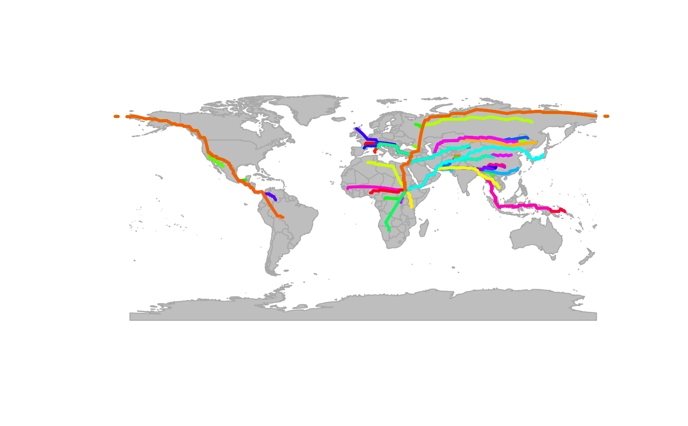
## plot the paths
plot(worldgraph.40k, col = NA, reset = TRUE)
#> Spherical geometry (s2) switched off
#> Spherical geometry (s2) switched on
plot(myPath)